
Vilano Beach & Porpoise Point seawall repair planning
Plan Vilano Beach seawall repairs with Porpoise Point project boundaries, inlet exposure, oceanfront review and private-property permit questions.
Describe your project on this page ↓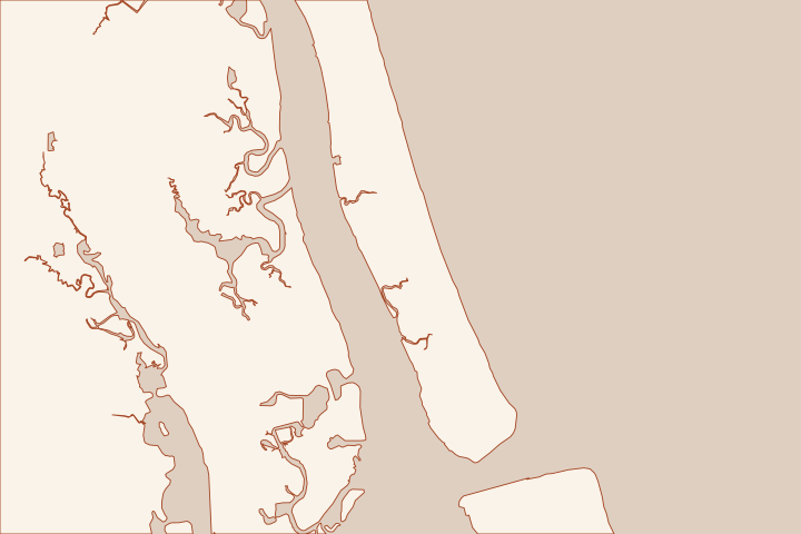
Get to know your waterfront
Vilano Beach includes ocean-facing, inlet-facing and Intracoastal frontage. Porpoise Point also has separate public armoring and shoreline-stabilization projects. Start with a map of the exact frontage and the adjacent public assets; a single Vilano label does not identify the design exposure or which project applies.
County Service Directory: Porpoise Point projects · Coastal Projects directory
Keep public armoring and private frontage distinct
The County describes the Porpoise Point Drive armoring as a roughly 172-foot steel-sheet-pile and concrete-cap link between an existing wall and rock revetment. It lists that project among completed work. A separate shoreline-stabilization project remains a design and permitting effort on the current directory. County Service Directory: Porpoise Point projects Coastal Projects directory County Service Directory: Porpoise Point projects
That distinction matters when an owner is told to wait for a public project or match a neighboring structure. Ask Coastal Management which plan covers the parcel’s edge, whether an easement applies and which connections remain the private owner’s responsibility.
Choose the right first question
| Location | Start with |
|---|---|
Ocean or inlet beach edge | Coastal armoring, dune and access review. |
Intracoastal wall | Wall condition, drainage, wetland boundaries and marine permits. |
Public road-end connection | Ownership, approved public detail and maintenance access. |
The South Ponte Vedra–Vilano nourishment project has a defined reach. It should not be presented as covering all of Porpoise Point or every private seawall. Use the project map and the parcel survey together. South Ponte Vedra and Vilano Beach Coastal Storm Risk Management Project South Ponte Vedra and Vilano Beach Coastal Storm Risk Management Project
Photograph end returns, exposed foundations and changes in the adjacent beach or bank. Ask the designer to separate urgent stabilization from the permanent solution and identify the written authorizations for each phase.
Local facts to carry into the site visit
- The County describes about 172 feet of steel sheet pile and reinforced concrete cap at Porpoise Point Drive.
- The Coastal Projects directory lists Porpoise Point Drive Armoring among completed projects.
- The County separately describes Porpoise Point Shoreline Stabilization as a design and permitting project.
- The South Ponte Vedra–Vilano project extends from Serenata Beach Club to about 250 feet north of Nease Beachfront Park.
- The County records first nourishment in 2020/2021 and a second event in 2023/2024 for that defined reach.
County Service Directory: Porpoise Point projects · Coastal Projects directory · County Service Directory: Porpoise Point projects · South Ponte Vedra and Vilano Beach Coastal Storm Risk Management Project · South Ponte Vedra and Vilano Beach Coastal Storm Risk Management Project
What could the work cost?
Break out equipment access, tie-ins to existing rock or wall, dune restoration, monitoring and temporary stabilization. A public armoring design gives useful questions, but not a material specification or price for a private lot.
Start with a published planning range, then refine it with a written price for your St. Augustine property.
Compare quotes and plan a budget →Find the relevant permits and records
| Starting point | What to resolve | Prepare and look up |
|---|---|---|
St. Johns County Building Department | Confirm the parcel jurisdiction, building review and any right-of-way or drainage approvals. | Provide the parcel ID, survey, photos and proposed work. 904-827-6800. |
Florida DEP / water management district | Check the Coastal Construction Control Line and coastal armoring review for the ocean side; ask separately about work in wetlands or tidal water. | Show existing and proposed alignment, habitat, access and disposal; request a written permit or exemption determination. |
U.S. Army Corps of Engineers | Ask whether the work needs federal authorization for structures or fill in jurisdictional waters. | Submit the same current drawings used for state review; keep each written determination in the project file. |
Match the address to the project map
Avoid basing a private repair on the name of a nearby public project.
Identify the shoreline face
Mark whether the property faces the ocean, inlet or Intracoastal. Include public road ends and the neighbor’s return structure on the survey.
County Service Directory: Porpoise Point projects · South Ponte Vedra and Vilano Beach Coastal Storm Risk Management Project
Ask about Porpoise Point scope
Request the final armoring drawing and the current shoreline-stabilization boundary where relevant. Keep completed work separate from a design-stage proposal.
Coastal Projects directory · County Service Directory: Porpoise Point projects
Confirm beach-side access
Describe equipment, storage and any dune crossing to the agencies. A public beach entrance is not approval for construction access.
South Ponte Vedra and Vilano Beach Coastal Storm Risk Management Project
Plan your Vilano Beach & Porpoise Point project
Save the shoreline details and questions you want a qualified marine contractor to review.
Clear guidance for your waterfront project.
Vilano Beach & Porpoise Point project questions
Is the Porpoise Point armoring project the same as shoreline stabilization?
No. The County lists the Drive armoring as completed and describes a separate shoreline-stabilization effort in design and permitting. Confirm which drawings apply to your location.
Coastal Projects directory · County Service Directory: Porpoise Point projects
Does the Vilano nourishment project extend along every local shoreline?
No. The County defines a specific oceanfront reach between the Serenata area and a point north of Nease Beachfront Park. Check the mapped limits for the parcel.
South Ponte Vedra and Vilano Beach Coastal Storm Risk Management Project
Keep planning
Nearby waterfront guides
North Beach & Usina, Camachee Island & Hospital Creek, South Ponte Vedra Beach
Show sourcesHide sources
- County Service Directory: Porpoise Point projectsSource reviewed 2026-10-26
- Coastal Projects directorySource reviewed 2026-10-26
- South Ponte Vedra and Vilano Beach Coastal Storm Risk Management ProjectSource reviewed 2026-10-26
- Building DepartmentSource reviewed 2026-10-27
- Coastal Construction Control Line ProgramSource reviewed 2026-10-26
- Nationwide Permit InformationSource reviewed 2026-10-26