
St. Augustine Shores & Moultrie seawall repair planning
Prepare St. Augustine Shores seawall work with ownership records, Matanzas marsh edges, Moultrie Creek context and a practical contractor checklist.
Describe your project on this page ↓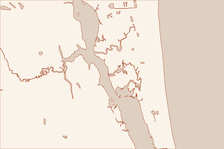
Get to know your waterfront
St. Augustine Shores includes a planned community beside the Intracoastal Waterway and protected waterfront landscape at Canopy Shores Park. Nearby Vaill Point lies between Moultrie Creek and the Intracoastal. The first repair decision is often what the owner actually controls: a private wall, a shared asset, a dock or a natural marsh edge.
LAMP Acquired Properties: Canopy Shores and Vaill Point · Canopy Shores Park
Identify the asset before choosing a wall
Start with the plat, survey and association documents where applicable. Ask who owns the shoreline, who maintains it and whose permission is needed for investigation and access. A view over common land or marsh does not establish a right to construct a bulkhead at the water’s edge.
The County describes Canopy Shores within the St. Augustine Shores planned unit development and identifies tidal marsh, floodplain swamp and hammock communities. Those descriptions show why an unbuilt edge should be assessed as habitat rather than assumed to be empty space awaiting a wall. They do not map the wetland line on an individual parcel. LAMP Acquired Properties: Canopy Shores and Vaill Point Canopy Shores Park LAMP Acquired Properties: Canopy Shores and Vaill Point
Match the proposal to the actual condition
- Existing wall: identify movement, cracks, lost soil and prior repairs by segment.
- Dock or shared frontage: obtain the governing approval and maintenance responsibility before seeking a construction price.
- Natural bank: ask for an erosion and habitat assessment before choosing hard armoring.
- Creek connection: show drainage and the neighboring waterway rather than treating the property as open-river frontage.
Vaill Point’s setting at Moultrie Creek and the Intracoastal gives a useful geographic reference, but its park access cannot be assumed available for private construction. Have bidders explain the land or water route they intend to use. LAMP Acquired Properties: Canopy Shores and Vaill Point LAMP Acquired Properties: Canopy Shores and Vaill Point
For an association project, agree on the condition report and scope before soliciting prices. Then compare equivalent investigation, design, environmental review and closeout records rather than only the final bid total.
Local facts to carry into the site visit
- The County identifies Canopy Shores Park within the St. Augustine Shores planned unit development.
- Canopy Shores Park is on Christina Drive beside the Riverview Club and along the Intracoastal Waterway.
- Canopy Shores contains hydric hammock, estuarine tidal marsh and floodplain swamp communities.
- Vaill Point Park is bordered by Moultrie Creek to the north.
- The Intracoastal Waterway forms Vaill Point Park’s eastern boundary.
LAMP Acquired Properties: Canopy Shores and Vaill Point · Canopy Shores Park · LAMP Acquired Properties: Canopy Shores and Vaill Point · LAMP Acquired Properties: Canopy Shores and Vaill Point · LAMP Acquired Properties: Canopy Shores and Vaill Point
What could the work cost?
Budget for ownership and records work, any habitat assessment, shared-asset coordination and access. Price a natural-bank alternative separately where a designer finds it appropriate; do not assume every eroding marsh edge calls for a new wall.
Start with a published planning range, then refine it with a written price for your St. Augustine property.
Compare quotes and plan a budget →Find the relevant permits and records
| Starting point | What to resolve | Prepare and look up |
|---|---|---|
St. Johns County Building Department | Confirm the parcel jurisdiction, building review and any right-of-way or drainage approvals. | Provide the parcel ID, survey, photos and proposed work. 904-827-6800. |
Florida DEP / water management district | Confirm the environmental resource, wetland and submerged-land review for the complete shoreline scope. | Show existing and proposed alignment, habitat, access and disposal; request a written permit or exemption determination. |
U.S. Army Corps of Engineers | Ask whether the work needs federal authorization for structures or fill in jurisdictional waters. | Submit the same current drawings used for state review; keep each written determination in the project file. |
Create one shoreline ownership record
This is especially useful when a sale, association or property manager is involved.
Locate the common and private land
Put the plat, survey and relevant association documents together. Ask which party can approve work on the wall, dock and access route.
LAMP Acquired Properties: Canopy Shores and Vaill Point · Canopy Shores Park
Screen the natural edge
Photograph the bank and vegetation from safe ground. Ask the environmental reviewer to identify the site’s wetland boundary and any restrictions on fill, clearing or armoring.
Document the creek connection
For the Moultrie side, identify the receiving water and access route on the plan. Obtain permission independently of nearby park or public-water access.
Plan your St. Augustine Shores & Moultrie project
Save the shoreline details and questions you want a qualified marine contractor to review.
Clear guidance for your waterfront project.
St. Augustine Shores & Moultrie project questions
Does waterfront ownership always mean a seawall is the right option?
No. The County documents tidal marsh and other natural communities around Canopy Shores. The property needs a condition, erosion and habitat assessment before selecting a stabilization method.
Canopy Shores Park · LAMP Acquired Properties: Canopy Shores and Vaill Point
Where is Vaill Point relative to the waterways?
The County places the park between Moultrie Creek on the north and the Intracoastal on the east. It is a useful location reference, not authorization for a private project to use the park.
Keep planning
Nearby waterfront guides
Show sourcesHide sources
- LAMP Acquired Properties: Canopy Shores and Vaill PointSource reviewed 2026-10-26
- Canopy Shores ParkSource reviewed 2026-10-26
- Building DepartmentSource reviewed 2026-10-27
- Northeast District PermittingSource reviewed 2026-10-26
- Nationwide Permit InformationSource reviewed 2026-10-26