
Crescent Beach seawall repair planning
Prepare Crescent Beach seawall work with Matanzas River access checks, Green Road constraints, restored-dune records and oceanfront permit steps.
Describe your project on this page ↓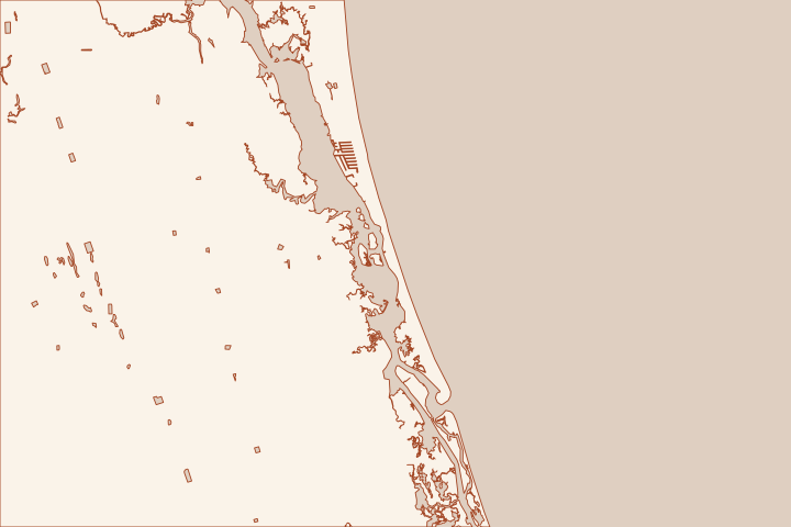
Get to know your waterfront
Crescent Beach owners may face the Matanzas River, the Atlantic beach or an internal water feature. Green Road provides a documented river access point, while the oceanfront has distinct dune-restoration reaches. Identify the shoreline on the first page of the project brief so a contractor prices the correct access and permit path.
Plan around a narrow access opportunity
The Green Road ramp provides Matanzas River access and has limited street parking. That combination should trigger a practical conversation about deliveries and staging, not an assumption that a commercial crew can occupy the road. Ask the contractor where equipment and material will actually go. Green Road Boat Ramp Green Road Boat Ramp
For river frontage, include dock piles, lifts, utilities and the available route beside the house in the site information. Ask whether the proposed work can be reached from land, requires water-based equipment or needs both. Have each bidder use the same assumptions before comparing totals.
Ocean-side work needs the restoration record
The County lists two Crescent Beach sections in its Ian/Nicole dune work and reports completion in January 2024. Those endpoints identify the public scope. They do not establish the present beach profile, the condition of buried armoring or what a private owner may excavate. Hurricane Ian/Nicole FEMA Dune Enhancement Project Hurricane Ian/Nicole FEMA Dune Enhancement Project
- Keep the current survey and any coastal-construction approval together.
- Photograph the dune and exposed structure without walking on unstable edges.
- Ask whether the proposed access crosses a public or private easement.
- Separate erosion of the beach from a structural defect in an existing wall.
A repair plan should also explain the end condition: how the wall meets neighboring frontage, where runoff goes and which disturbed surfaces are restored. That is easier to evaluate on a drawing than in a broad promise to stabilize the shoreline.
Local facts to carry into the site visit
- Green Road Boat Ramp at 180 Green Road provides access to the Matanzas River and Intracoastal Waterway.
- The County lists limited street parking at Green Road Boat Ramp.
- The County’s Crescent Beach dune project includes Cubbedge Road to 7172 A1A South.
- Its second Crescent Beach section extends from 7560 A1A South to the Fort Matanzas ramp; completion is listed as January 2024.
- The coastal management map identifies Crescent Beach as the reach from R-173 to R-193.7.
Green Road Boat Ramp · Green Road Boat Ramp · Hurricane Ian/Nicole FEMA Dune Enhancement Project · Hurricane Ian/Nicole FEMA Dune Enhancement Project · Coastal Management Plan and reach map
What could the work cost?
Have the estimate identify road access, marine equipment, monitoring and restoration separately. For beach-side work, ask which coastal survey and design tasks are included before accepting a per-foot construction rate.
Start with a published planning range, then refine it with a written price for your St. Augustine property.
Compare quotes and plan a budget →Find the relevant permits and records
| Starting point | What to resolve | Prepare and look up |
|---|---|---|
St. Johns County Building Department | Confirm the parcel jurisdiction, building review and any right-of-way or drainage approvals. | Provide the parcel ID, survey, photos and proposed work. 904-827-6800. |
Florida DEP / water management district | Check the Coastal Construction Control Line and coastal armoring review for the ocean side; ask separately about work in wetlands or tidal water. | Show existing and proposed alignment, habitat, access and disposal; request a written permit or exemption determination. |
U.S. Army Corps of Engineers | Ask whether the work needs federal authorization for structures or fill in jurisdictional waters. | Submit the same current drawings used for state review; keep each written determination in the project file. |
Give bidders an access and records packet
Keep the water-side and road-side constraints visible throughout the estimate.
Document Green Road constraints
If the contractor proposes using Green Road, ask who grants permission and where staging occurs. Limited public parking is not a construction compound.
Locate the public sand placement
Check whether the ocean parcel lies within the County’s stated restoration endpoints. Request the applicable plans or easement information rather than assuming all Crescent Beach lots were included.
Request two clear scope drawings
Ask for an existing-condition plan and a proposed-work plan showing wall limits, drains, access and restoration. List any extra dredging or dock work separately for review.
Plan your Crescent Beach project
Save the shoreline details and questions you want a qualified marine contractor to review.
Clear guidance for your waterfront project.
Crescent Beach project questions
Can a contractor use Green Road simply because it is a public ramp?
The County lists a public recreational ramp with limited parking. Confirm the proposed commercial use, equipment suitability and any required permissions with the facility and road owners.
Was all Crescent Beach covered by one dune project?
The County identifies specific address ranges, rather than every frontage. Match the parcel to those limits and ask for the current record if a restored dune could be disturbed.
Keep planning
Nearby waterfront guides
Butler Beach, Summer Haven & Matanzas Inlet, St. Augustine Shores & Moultrie
Show sourcesHide sources
- Green Road Boat RampSource reviewed 2026-10-26
- Hurricane Ian/Nicole FEMA Dune Enhancement ProjectSource reviewed 2026-10-26
- Coastal Management Plan and reach mapSource reviewed 2026-10-26
- Building DepartmentSource reviewed 2026-10-27
- Coastal Construction Control Line ProgramSource reviewed 2026-10-26
- Nationwide Permit InformationSource reviewed 2026-10-26