
Orangedale & Switzerland seawall repair planning
Plan St. Johns River bulkhead repairs near Orangedale and Switzerland with creek access checks, natural-bank context and property-specific permits.
Describe your project on this page ↓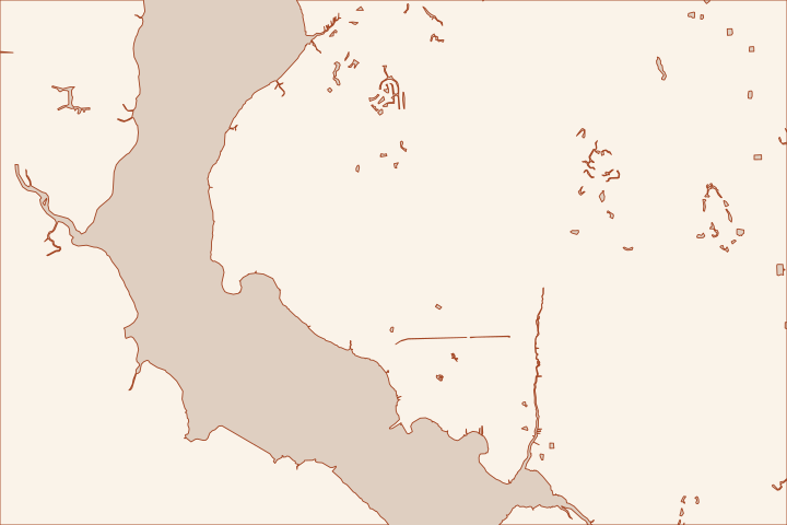
Get to know your waterfront
The western St. Johns County shoreline is a different setting from the Atlantic barrier islands. Trout Creek connects the Orangedale area to the St. Johns River, and the Bartram corridor continues through Switzerland. Describe whether the property faces the broad river or a creek before comparing stabilization methods and equipment access.
Start with bank shape and river exposure
A bulkhead may be only one part of the problem. Give the assessor photographs of the bank above the wall, the visible toe, nearby trees and the transition to neighboring shoreline. Ask what evidence is needed to distinguish surface erosion, drainage through the bank and movement of the retaining structure.
The County identifies Trout Creek as a freshwater tributary with river access from its park. That does not mean every creek frontage has the same access or conditions as open-river frontage. Have the contractor explain the actual water route, work platform and any limitations imposed by the bank. Trout Creek Community Park and Boat Ramp Trout Creek Community Park and Boat Ramp
Check the upland as well as the wall
- Mark roof drains, yard drainage and other discharge points on the site sketch.
- Show trees and proposed excavation so the designer can assess conflicts.
- Ask where removed material will go and how the bank is protected during work.
- Record the adjoining shoreline condition before equipment arrives.
Alpine Groves Park in the Switzerland area contains bluff and wetland settings beside the river. It is a reminder to use the actual site profile rather than assume a flat coastal canal lot. Park descriptions do not establish soil properties or slope stability for a nearby home. Alpine Groves Park: setting and restoration history Alpine Groves Park: setting and restoration history
Ask for a comparison of repairing the existing structure and any appropriate bank-stabilization alternative. The recommendation should follow the condition assessment and environmental review. A convenient material choice should not decide whether a natural edge becomes a new vertical wall.
Local facts to carry into the site visit
- The County identifies Trout Creek as a freshwater tributary of the St. Johns River.
- Trout Creek Park at 6795 Collier Road provides access to the creek and St. Johns River.
- The William Bartram corridor plan identifies Switzerland and Orangedale along the western County route.
- County park records describe shoreline and bluff restoration at Alpine Groves Park beside the St. Johns River.
- The County records 2022 bluff and shoreline stabilization with native plants to restore wetlands at Alpine Groves Park.
Trout Creek Community Park and Boat Ramp · Trout Creek Community Park and Boat Ramp · William Bartram Scenic and Historic Highway Corridor Management Plan · Alpine Groves Park: setting and restoration history · Alpine Groves Park: setting and restoration history
What could the work cost?
Have the budget separate bank investigation, access over sloping ground, tree or utility conflicts, marine equipment and restoration. Do not import beach-front construction rates or presume that river frontage removes wetland and federal review.
Start with a published planning range, then refine it with a written price for your St. Augustine property.
Compare quotes and plan a budget →Find the relevant permits and records
| Starting point | What to resolve | Prepare and look up |
|---|---|---|
St. Johns County Building Department | Confirm the parcel jurisdiction, building review and any right-of-way or drainage approvals. | Provide the parcel ID, survey, photos and proposed work. 904-827-6800. |
Florida DEP / water management district | Confirm the environmental resource, wetland and submerged-land review for the complete shoreline scope. | Show existing and proposed alignment, habitat, access and disposal; request a written permit or exemption determination. |
U.S. Army Corps of Engineers | Ask whether the work needs federal authorization for structures or fill in jurisdictional waters. | Submit the same current drawings used for state review; keep each written determination in the project file. |
Create a riverbank condition brief
Use the same profile, observations and work limits when requesting competing proposals.
Identify river or creek frontage
State the receiving water and provide a sketch of the route from the channel to the work. Note any existing dock or launch that the contractor proposes using.
Record the bank profile
Ask the surveyor or designer what topographic information is needed from the upland to the toe. Include discharge points and nearby structures in the brief.
Confirm the allowable footprint
Submit the proposed wall, fill, excavation and temporary access as one scope for agency review. Keep public park access separate from permission for private construction.
Trout Creek Community Park and Boat Ramp · William Bartram Scenic and Historic Highway Corridor Management Plan
Plan your Orangedale & Switzerland project
Save the shoreline details and questions you want a qualified marine contractor to review.
Clear guidance for your waterfront project.
Orangedale & Switzerland project questions
Are creek and open-river bulkheads interchangeable designs?
No. The County maps Trout Creek as a tributary connection to the river. Site exposure, bank geometry, access and existing condition still need property-specific assessment.
Can a natural bank be replaced with a wall without review?
Do not assume that. Ask the local and environmental authorities to evaluate the proposed structure, fill and disturbance before selecting a method or beginning work.
Keep planning
Nearby waterfront guides
Palm Valley, St. Augustine Shores & Moultrie, St. Augustine South
Show sourcesHide sources
- Trout Creek Community Park and Boat RampSource reviewed 2026-10-26
- Alpine Groves Park: setting and restoration historySource reviewed 2026-10-26
- William Bartram Scenic and Historic Highway Corridor Management PlanSource reviewed 2026-10-26
- Building DepartmentSource reviewed 2026-10-27
- Northeast District PermittingSource reviewed 2026-10-26
- Nationwide Permit InformationSource reviewed 2026-10-26