Find your waterfront. Understand what makes it different.
From the historic bayfront to tidal creeks, Atlantic beaches and the St. Johns River: 16 researched guides for your next decision.
St. Augustine & nearby waterfronts
Explore the coast. Find your starting point.
From the historic bayfront to the beaches, tidal rivers and St. Johns River: find the questions that matter for your shoreline.
Full local guide
Choose a label to open local resources →Tap a community on the map or below ↗
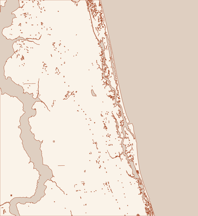
Land and water: U.S. Census Bureau. Places: USGS GNIS, city and county GIS. General reference; small unnamed ponds omitted. Markers are places or landmarks, not property or permit boundaries.
Your local starting point
Find your community.
Choose a guide for local maps, permit starting points and the records to gather for your property.
The downtown bayfront has more than one generation of shoreline construction. Beside the Municipal Marina, the City’s Avenida Menendez project addresses a lower link between earlier works. Read that public project as a lesson about connections and drainage, not as a design approval for a private waterfront lot.
Lincolnville’s waterfront questions sit beside a neighborhood drainage history. The City’s South and DeHaven Street project combined storm drainage with water, sewer and road work. Around Lake Maria Sanchez, another public scheme combines pumping, valves and a floodwall. These records help you describe the problem before asking for a wall repair.
Davis Shores is a useful example of why salt water in a street is not automatically a broken private seawall. The City documents tide-driven backflow through its drainage network, which discharges to the Matanzas River and Salt Run. Begin with the entry route, then investigate the wall and any nearby outlet together.
Salt Run combines residential shorelines, moorings, public access and a maintained navigation channel. The City describes the mooring area as shallower water with limited shore-side amenities. A contractor therefore needs more than frontage length: the proposed equipment route, draft and working tides belong in the first discussion.
Camachee Cove’s entrance is part of the Tolomato River waterfront. A 2023 Corps notice documents proposed marina modifications at Harbor Drive, including entrance protection and habitat work. That record makes this area a strong case for checking the exact authorization and ownership before treating a shoreline structure as an ordinary residential wall.
Vilano Beach includes ocean-facing, inlet-facing and Intracoastal frontage. Porpoise Point also has separate public armoring and shoreline-stabilization projects. Start with a map of the exact frontage and the adjacent public assets; a single Vilano label does not identify the design exposure or which project applies.
North Beach has a County drainage study that directly compares shoreline and road-based solutions. It documents street-end flap gates, earlier berms and a raised Boating Club Road ramp. That history is more useful than a generic promise that a taller seawall will keep every property dry.
St. Augustine Beach is a separate municipality with its own Building Department. Its oceanfront also lies within a federal shore-protection setting. A mailing address, public nourishment project and private coastal permit answer different questions; verify all three before assuming a proposed seawall repair can proceed.
Butler Beach has two very different waterfront settings. Frank Butler Park West gives access to the Matanzas River, while the ocean side has dune habitat and a history of public sand placement. A useful repair brief starts by identifying which side of Anastasia Island the property faces.
Crescent Beach owners may face the Matanzas River, the Atlantic beach or an internal water feature. Green Road provides a documented river access point, while the oceanfront has distinct dune-restoration reaches. Identify the shoreline on the first page of the project brief so a contractor prices the correct access and permit path.
Shore Drive has public waterfront places as well as residential frontage. Douglas C. Crane Boat Ramp accesses the Matanzas River; Shore Drive Park farther south sits on Moultrie Creek. Before assuming a damaged edge belongs to the adjacent house, put the parcel boundary and any public land on the same drawing.
St. Augustine Shores includes a planned community beside the Intracoastal Waterway and protected waterfront landscape at Canopy Shores Park. Nearby Vaill Point lies between Moultrie Creek and the Intracoastal. The first repair decision is often what the owner actually controls: a private wall, a shared asset, a dock or a natural marsh edge.
Summer Haven’s public records describe repeated river infilling, overwash and coastal protection work. This is an inlet and beach-management problem as well as a private-property repair setting. Before a contractor proposes a wall or rock repair, establish the current shoreline, ownership and relationship to the County’s separate projects.
South Ponte Vedra has several named coastal projects with different limits and schedules. The County’s Category G project is distinct from the South Ponte Vedra–Vilano federal reach. The safest first step is to match the parcel to a specific map and approval rather than assuming that any project bearing the area’s name covers the property.
Palm Valley frontage includes the Intracoastal corridor and adjoining canals. The County provides public ramps on both sides of the Palm Valley Bridge, while Nocatee Preserve lies along the estuary to the south. An address near the water is not enough to price access: the actual bank, canal approach and staging route matter.
The western St. Johns County shoreline is a different setting from the Atlantic barrier islands. Trout Creek connects the Orangedale area to the St. Johns River, and the Bartram corridor continues through Switzerland. Describe whether the property faces the broad river or a creek before comparing stabilization methods and equipment access.