
Davis Shores seawall repair planning
Plan Davis Shores seawall repairs around tidal backflow, stormwater outfalls, Coquina Avenue drainage and the condition of your private shoreline.
Describe your project on this page ↓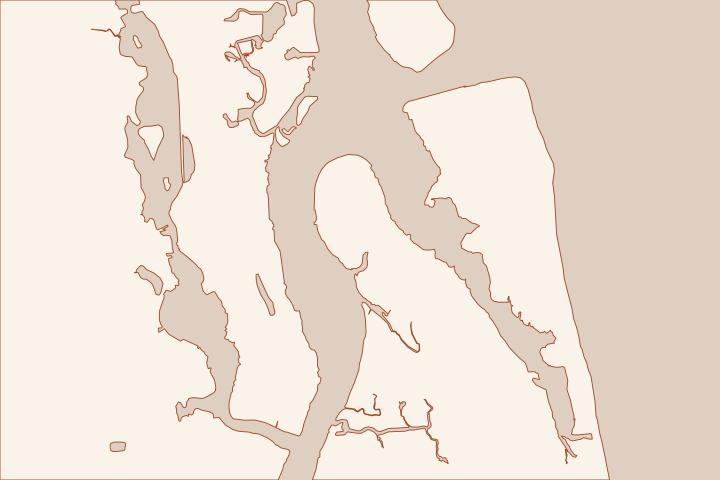
Get to know your waterfront
Davis Shores is a useful example of why salt water in a street is not automatically a broken private seawall. The City documents tide-driven backflow through its drainage network, which discharges to the Matanzas River and Salt Run. Begin with the entry route, then investigate the wall and any nearby outlet together.
Distinguish backflow from wall failure
| Observation | Question for the reviewer |
|---|---|
Water rises from a street inlet | Does a public outfall or tide valve serve this drainage area? |
Soil disappears beside the cap | Where is fill leaving, and is there a hidden void? |
The wall visibly leans | What access restrictions and structural investigation are needed? |
The City identifies approximately 21 outfalls in Davis Shores. That is a neighborhood system count; it does not establish that any particular property has a valve or a completed upgrade. Ask for the outlet identifier and current maintenance responsibility. Tidal Flooding Mitigation: South Davis Shores Tidal Flooding Mitigation: South Davis Shores
Coquina Park was designed as both green space and flood protection. The South Davis Shores drainage project also has its own design history, including a November 2025 meeting on a 30% design. Read the current project page before assuming a concept has been built. Coquina Park South Davis Shores Neighborhood Drainage Project
For a wall proposal, ask the designer how yard drainage, end returns, street levels and existing public infrastructure fit together. Include the location of docks and utilities in the brief. A higher cap should not be selected from a neighborhood photograph; use surveyed elevations and an explanation of where water will drain afterward.
Local facts to carry into the site visit
- The City describes seawater entering Davis Shores storm drains during high-tide events.
- The Davis Shores stormwater system has approximately 21 outfalls discharging to the Matanzas River or Salt Run.
- The City’s Davis Shores explanation distinguishes tidal flooding from ordinary street stormwater discharge.
- Coquina Park at 91 Coquina Avenue was designed to provide green space and coastal flood resilience.
- A November 2025 City meeting presented the 30% design for South Davis Shores drainage improvements.
Tidal Flooding Mitigation: South Davis Shores · Tidal Flooding Mitigation: South Davis Shores · Tidal Flooding Mitigation: South Davis Shores · Coquina Park · South Davis Shores Neighborhood Drainage Project
What could the work cost?
Obtain separate allowances for private-wall investigation, outlet coordination, drainage alterations and restoration. A public backflow project does not supply a private repair price or promise protection for the whole lot.
Start with a published planning range, then refine it with a written price for your St. Augustine property.
Compare quotes and plan a budget →Find the relevant permits and records
| Starting point | What to resolve | Prepare and look up |
|---|---|---|
City of St. Augustine Planning & Building | Confirm the parcel jurisdiction, building review and any right-of-way or drainage approvals. | Provide the parcel ID, survey, photos and proposed work. 904-825-1065. |
Florida DEP / water management district | Confirm the environmental resource, wetland and submerged-land review for the complete shoreline scope. | Show existing and proposed alignment, habitat, access and disposal; request a written permit or exemption determination. |
U.S. Army Corps of Engineers | Ask whether the work needs federal authorization for structures or fill in jurisdictional waters. | Submit the same current drawings used for state review; keep each written determination in the project file. |
Prepare a Davis Shores evidence pack
A short record of when and where water appears is more useful than a request to make the wall higher.
Log the event
Record the date, rainfall, water direction and affected inlet or wall segment. Stay clear of unstable edges and take photographs from firm ground.
Ask about the public outlet
Send Public Works the nearest street intersection and photographs. Request the relevant outlet record and any current Coquina Avenue project drawing.
Tidal Flooding Mitigation: South Davis Shores · South Davis Shores Neighborhood Drainage Project
Compare a complete scope
Have proposals address the same wall limits, drainage interfaces and restoration. Keep public-system maintenance separate from work that the owner can authorize.
Tidal Flooding Mitigation: South Davis Shores · Coquina Park
Plan your Davis Shores project
Save the shoreline details and questions you want a qualified marine contractor to review.
Clear guidance for your waterfront project.
Davis Shores project questions
Does Davis Shores flooding always mean a seawall failed?
No. The City describes tidal water entering the stormwater network and backing into streets. Wall movement and soil loss need investigation, but the flooding route should be established separately.
Can I assume the 2025 drainage concept is complete?
No. The cited page documents a meeting about the 30% design. Obtain a current status and location-specific drawings before relying on it in a private construction plan.
Keep planning
Nearby waterfront guides
Salt Run & Lighthouse Park, Historic Downtown & Bayfront, St. Augustine Beach
Show sourcesHide sources
- Tidal Flooding Mitigation: South Davis ShoresSource reviewed 2026-10-26
- Coquina ParkSource reviewed 2026-10-26
- South Davis Shores Neighborhood Drainage ProjectSource reviewed 2026-10-26
- Building Permit Information: bulkhead/retaining wallSource reviewed 2026-10-26
- Northeast District PermittingSource reviewed 2026-10-26
- Nationwide Permit InformationSource reviewed 2026-10-26