
Palm Valley seawall repair planning
Plan Palm Valley bulkhead and seawall repairs with Intracoastal access checks, canal records, marsh boundaries and a clear marine-work scope.
Describe your project on this page ↓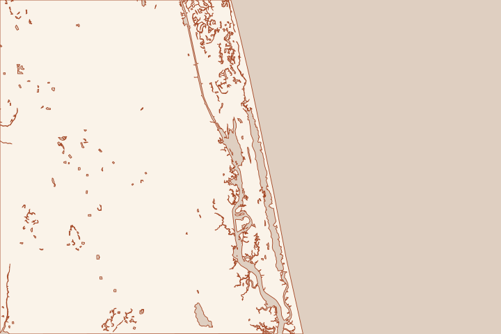
Get to know your waterfront
Palm Valley frontage includes the Intracoastal corridor and adjoining canals. The County provides public ramps on both sides of the Palm Valley Bridge, while Nocatee Preserve lies along the estuary to the south. An address near the water is not enough to price access: the actual bank, canal approach and staging route matter.
Palm Valley East Boat Ramp · Palm Valley West Boat Ramp project
Distinguish main-channel frontage from a canal site
A contractor should see the water route and land route before committing to equipment. Show the wall, lifts, docks, canal mouth and property boundaries on the brief. Ask what observations or current depth information are needed to confirm access; a nearby ramp does not prove that a barge can reach or work at the wall.
Read the property’s existing approvals before laying out access or staging. The County’s 513 Canal variance record describes a garage request involving reduced setbacks and increased building coverage. That record concerns a particular parcel and structure; it does not establish seawall setbacks or permission to build at another address. Ask the designer to check the survey, recorded restrictions and applicable approvals for your property. ZVAR 2024-16: 513 Canal Variance application record
Keep the natural edge visible in the plan
Nocatee Preserve’s documented estuarine setting illustrates that this corridor contains conserved and natural frontage as well as developed walls. Have the environmental reviewer establish the habitat and wetland boundary at the actual site before proposing fill, clearing or a changed alignment. Nocatee Preserve
- Ask what is retaining soil today: a wall, natural bank, rock or another feature.
- Separate wall repair from any dredging or dock enlargement in the proposal.
- Identify an authorized staging site and who restores it.
- Specify how vessel access is maintained during each construction stage.
The east and west public ramps have different addresses and approaches. Name the proposed facility explicitly and ask the responsible owner about construction use. Do not leave access as an assumption that is resolved only after the contract is signed. Palm Valley East Boat Ramp Palm Valley West Boat Ramp project Palm Valley West Boat Ramp project
Local facts to carry into the site visit
- Palm Valley East Boat Ramp at 383 South Roscoe Boulevard provides Intracoastal access.
- Palm Valley West Boat Ramp is at 230 Lori Lane on the west bank beneath the bridge.
- The County records the opening of Palm Valley West Boat Ramp on December 13, 2023.
- The County’s 513 Canal variance record documents a garage request involving reduced setbacks and increased building coverage; it is a parcel-specific case, not a seawall approval.
- Nocatee Preserve lies south of Palm Valley Bridge on the estuary opposite Guana Preserve.
Palm Valley East Boat Ramp · Palm Valley West Boat Ramp project · Palm Valley West Boat Ramp project · ZVAR 2024-16: 513 Canal Variance application record · Nocatee Preserve
What could the work cost?
Price access verification, marine mobilization, dock conflicts, environmental review and restoration separately. Compare canal and main-channel proposals on their actual equipment needs; a single regional price per foot hides these differences.
Start with a published planning range, then refine it with a written price for your St. Augustine property.
Compare quotes and plan a budget →Find the relevant permits and records
| Starting point | What to resolve | Prepare and look up |
|---|---|---|
St. Johns County Building Department | Confirm the parcel jurisdiction, building review and any right-of-way or drainage approvals. | Provide the parcel ID, survey, photos and proposed work. 904-827-6800. |
Florida DEP / water management district | Confirm the environmental resource, wetland and submerged-land review for the complete shoreline scope. | Show existing and proposed alignment, habitat, access and disposal; request a written permit or exemption determination. |
U.S. Army Corps of Engineers | Ask whether the work needs federal authorization for structures or fill in jurisdictional waters. | Submit the same current drawings used for state review; keep each written determination in the project file. |
Start with a two-route access sketch
Have each bidder use the same documented route and scope assumptions.
Locate the frontage
Mark the property relative to the canal mouth or Intracoastal channel. Supply the survey and any existing wall and dock permits together.
Name the equipment route
Identify east-bank, west-bank or private access and obtain permission from the owner. Ask the contractor to state any draft, clearance or staging conditions that affect the price.
Palm Valley East Boat Ramp · Palm Valley West Boat Ramp project
Separate habitat and construction limits
Show vegetation, proposed fill and temporary platforms for the environmental review. Keep work off neighboring or conserved land unless the required authorization exists.
Plan your Palm Valley project
Save the shoreline details and questions you want a qualified marine contractor to review.
Clear guidance for your waterfront project.
Palm Valley project questions
Does either Palm Valley public ramp guarantee construction access?
No. The County describes public boating facilities. Equipment suitability, staging, commercial use and any special permissions must be confirmed for the proposed work.
Palm Valley East Boat Ramp · Palm Valley West Boat Ramp project
Should dock and seawall work be quoted together?
They can be coordinated, but the scope should identify each structure and any dredging separately. That lets the agencies and bidders evaluate the same complete plan.
Keep planning
Nearby waterfront guides
South Ponte Vedra Beach, North Beach & Usina, Orangedale & Switzerland
Show sourcesHide sources
- Palm Valley East Boat RampSource reviewed 2026-10-26
- Palm Valley West Boat Ramp projectSource reviewed 2026-10-26
- ZVAR 2024-16: 513 Canal Variance application recordSource reviewed 2026-10-26
- Nocatee PreserveSource reviewed 2026-10-26
- Building DepartmentSource reviewed 2026-10-27
- Northeast District PermittingSource reviewed 2026-10-26
- Nationwide Permit InformationSource reviewed 2026-10-26