
Butler Beach seawall repair planning
Plan Butler Beach seawall repairs by distinguishing Matanzas River frontage from ocean dunes, with local project records and access questions.
Describe your project on this page ↓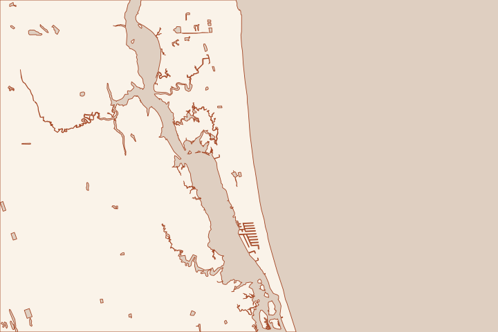
Get to know your waterfront
Butler Beach has two very different waterfront settings. Frank Butler Park West gives access to the Matanzas River, while the ocean side has dune habitat and a history of public sand placement. A useful repair brief starts by identifying which side of Anastasia Island the property faces.
Choose the shoreline problem before the material
A riverfront bulkhead, a dune escarpment and a failing garden retaining wall should not receive the same proposal. Describe the structure’s position relative to the water, the house and the property line. Photograph any exposed wall toe, missing soil and the transition into neighboring frontage without approaching unstable ground.
On the ocean side, the County’s 2023 Butler Beach work placed sand and vegetation in specified reaches after Hurricanes Ian and Nicole. It did not give every owner permission to build or enlarge a seawall. Check the current coastal permit and project boundary before disturbing a restored dune. Butler Beach Reach completion, September 22, 2023 Butler Beach Reach completion, September 22, 2023
Use both sides of the island in the access discussion
- River frontage: ask about the equipment’s draft, launch route and working room beside docks.
- Ocean frontage: ask about beach access, dune protection and any required biological monitoring.
- Land access: measure the route between buildings and record any trees, utilities or septic components that constrain it.
The County describes sensitive dune habitat at Frank Butler Park East, including beach mice and gopher tortoises. That is a reason to ask for a site-specific ecological review, not evidence that a particular animal is present on your lot. Beach Pavilions: Frank B. Butler Park East
For Matanzas frontage, the public ramp is a useful map landmark. Its presence does not authorize commercial staging or establish that construction equipment can reach a private wall. Include access and restoration responsibilities in the written proposal. Frank Butler Park West and Boat Ramp
Local facts to carry into the site visit
- The 2023 Butler Beach reach included Ocean Hammock Park to Bryn Mawr and a section south of Mary Street.
- The County reports placing sand, planting sea oats and installing protective fencing in that completed Butler Beach work.
- Frank Butler Park West on Riverside Boulevard provides access to the Matanzas River.
- The County coastal reach map places Butler Beach between range monuments R-155.6 and R-173.
- The County describes beach-mouse and gopher-tortoise habitat in the sensitive dunes at Frank Butler Park East.
Butler Beach Reach completion, September 22, 2023 · Butler Beach Reach completion, September 22, 2023 · Frank Butler Park West and Boat Ramp · Coastal Management Plan and reach map · Beach Pavilions: Frank B. Butler Park East
What could the work cost?
Compare river-side mobilization separately from ocean-side access and ecological controls. Ask for quantities, restoration limits and the assumptions behind any allowance; a public dune project budget cannot be converted into a private seawall price.
Start with a published planning range, then refine it with a written price for your St. Augustine property.
Compare quotes and plan a budget →Find the relevant permits and records
| Starting point | What to resolve | Prepare and look up |
|---|---|---|
St. Johns County Building Department | Confirm the parcel jurisdiction, building review and any right-of-way or drainage approvals. | Provide the parcel ID, survey, photos and proposed work. 904-827-6800. |
Florida DEP / water management district | Check the Coastal Construction Control Line and coastal armoring review for the ocean side; ask separately about work in wetlands or tidal water. | Show existing and proposed alignment, habitat, access and disposal; request a written permit or exemption determination. |
U.S. Army Corps of Engineers | Ask whether the work needs federal authorization for structures or fill in jurisdictional waters. | Submit the same current drawings used for state review; keep each written determination in the project file. |
Prepare separate river and ocean questions
Bring one sketch that makes the frontage and proposed work unambiguous.
Identify the shoreline face
Mark the parcel on the survey and show the receiving water, dune or marsh edge. Do not let a Butler Beach mailing address substitute for this distinction.
Frank Butler Park West and Boat Ramp · Coastal Management Plan and reach map
Retrieve the dune record if relevant
Ask Coastal Management whether the oceanfront lies in the 2023 sand-placement limits and whether existing easements or maintenance conditions affect the proposal.
Set the access limits
Show all potential equipment routes and who owns them. Have the contractor state what approvals, protection and restoration are included before accepting an access allowance.
Frank Butler Park West and Boat Ramp · Beach Pavilions: Frank B. Butler Park East
Plan your Butler Beach project
Save the shoreline details and questions you want a qualified marine contractor to review.
Clear guidance for your waterfront project.
Butler Beach project questions
Does Butler Beach use one permit path on both coasts?
The local parcel review starts with the County, but ocean-side coastal construction and work in tidal waters can involve different state review paths. Describe the exact footprint and ask for written determinations.
Frank Butler Park West and Boat Ramp · Coastal Management Plan and reach map
Did the public dune project authorize private seawalls?
The cited project placed sand and stabilizing vegetation in specific reaches. It should not be read as authorization to construct, enlarge or repair a private coastal structure.
Keep planning
Nearby waterfront guides
St. Augustine Beach, Crescent Beach, St. Augustine Shores & Moultrie
Show sourcesHide sources
- Butler Beach Reach completion, September 22, 2023Source reviewed 2026-10-26
- Beach Pavilions: Frank B. Butler Park EastSource reviewed 2026-10-26
- Frank Butler Park West and Boat RampSource reviewed 2026-10-26
- Coastal Management Plan and reach mapSource reviewed 2026-10-26
- Building DepartmentSource reviewed 2026-10-27
- Coastal Construction Control Line ProgramSource reviewed 2026-10-26
- Nationwide Permit InformationSource reviewed 2026-10-26